History: St. John's Episcopal Church
St. John St. James was created in the 1960s as the merger of St. John's on Tremont Street, Roxbury Crossing, and St. James, Roxbury. The maps and photos below provide a look at the original location of St. John's Episcopal Church.
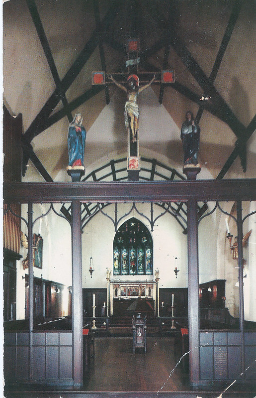
St. John's was noted for the unique liturgy and for the social activism of the congregation. The church exemplified the style of "English Use" inspired by pre-reformation England. In this photo, note the "rood screen," and the spacious sanctuary with low east-window--hence the altar is relatively low and horizontal, without the heaped trophy effect found elsewhere. St. John's developed its English Use ornaments and ceremonial under the decades-long tutelage of the Reverend Frederic Whitney Fitts (1872-1945). The social activism of the church grew, especially under the leadership of the Reverend Gilbert S. Avery (1960-1966) and the Reverend Richard D'Onofrio (1967-1972). Reverend D'Onofrio's leadership spanned the last years of St. John's and the first years of the merged St. John St. James congregation.
Thank you to Warren Steel for the postcard image.
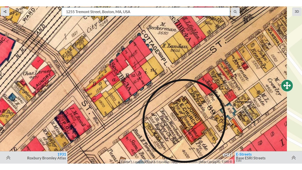
St. John's was originally founded as a mission of St. James. It was located at 1255 Tremont Street in Roxbury Crossing, on the section of Tremont Street that is now the back of Madison Park Vocational Technical High School, across from Boston Police Headquarters, near the Whittier Heath Center. This 1931 map from the MapJunction.com website shows the church, on Tremont St., across from Cottage St., and between Linden Park and Vernon Streets. Cottage Street and Linden Park no longer exist, and Vernon St. is a small street that goes to the parking lot of Madison Park HS.
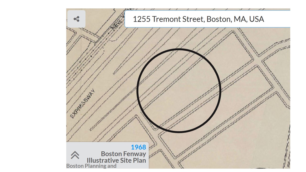
Both congregations lost their church buildings in the 1960s. While St. James Church was torn down as part of urban renewal, St. John's church was sold because the church and the land were in the path of the planned Inner Belt Highway. The highway project, a proposed extension of I-95 through the heart of Boston, was ultimately stopped by community protests, but resulted in extensive land clearance in Roxbury before it was stopped. The building was damaged by fire in April 1967.
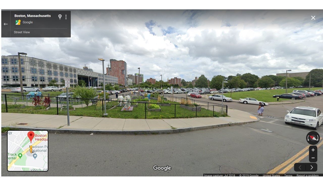
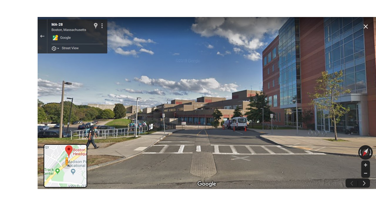
These Google Street View images shows the location today, behind Madison Park Vocational Technical High School, across from the Boston Police Headquarters and next to the Whittier Street Health Center
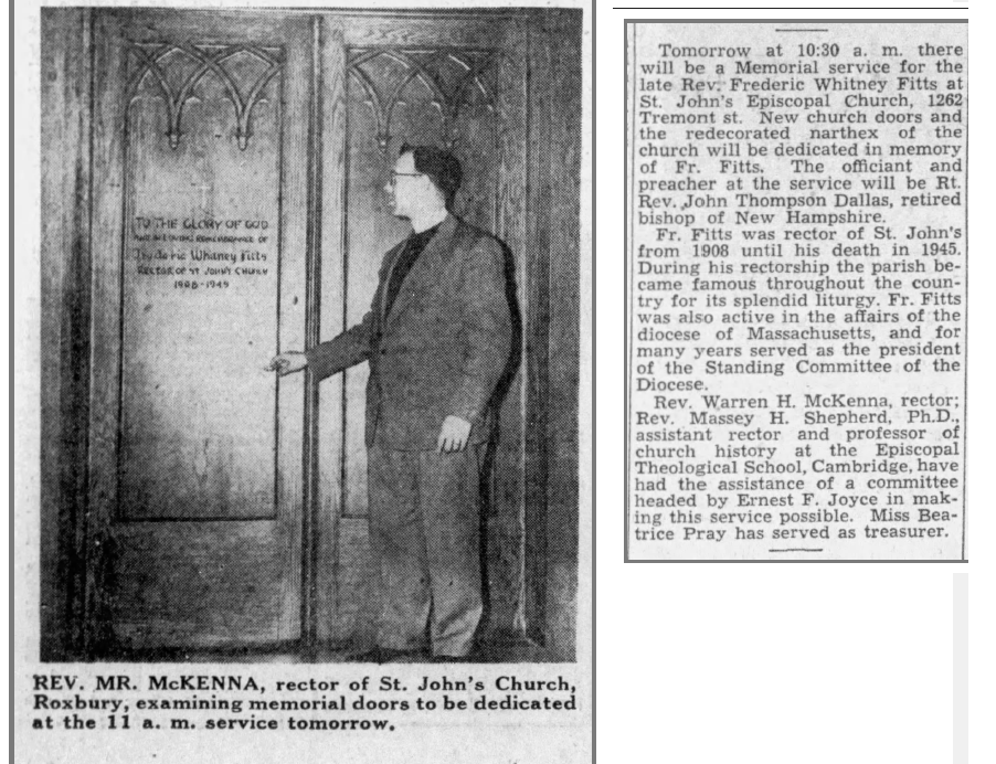 From the Boston Globe, December 16, 1950. Dedication of memorial doors at
St. John's Episcopal Church. These doors were designed as a memorial to the
long-time pastor, Rev. Fitts.
Rev. Warren McKenna officiated at this memorial service and dedication.
From the Boston Globe, December 16, 1950. Dedication of memorial doors at
St. John's Episcopal Church. These doors were designed as a memorial to the
long-time pastor, Rev. Fitts.
Rev. Warren McKenna officiated at this memorial service and dedication.
December 14, 2019